Ohrid to Tirana & the Adriatic: Cross-Border Road Trip
Drive Ohrid to Tirana and the Adriatic: the Qafe Thane border, the Shkumbin valley, Elbasan castle, the capital and the beaches at Durres.
If you’ve done Lake Ohrid and want to keep going, the drive from Ohrid to Tirana is one of the easiest border crossings in the Balkans: about 130 km and two and a half to three hours through the mountains, then a fast run down to the Adriatic at Durres, roughly 40 km past the capital. Stretch it over two days and you get a lake, an Ottoman castle town, a lively capital and a swim in the sea, all in one line across the map.
This route leaves the lake for good and heads west into Albania, so it pairs naturally with a few days on Ohrid first. This same Ohrid-to-Tirana stretch is the middle leg of the four-country Balkan Grand Loop, which carries the drive on up the Adriatic into Montenegro and Croatia if you have ten days rather than two. You want a car: the drive is the point, and the Shkumbin valley between the border and Elbasan isn’t somewhere you want to be stuck waiting for a connection. If you would rather not drive it, there are direct buses, and I’ve flagged that option below.
The route at a glance
| Leg | Distance | Notes |
|---|---|---|
| Ohrid → Struga → border | ~27 km | Lake shore, then Qafe Thane crossing |
| Border → Elbasan | ~73 km | Down the Shkumbin valley via Librazhd |
| Elbasan → Tirana | ~31 km | A3 motorway and the Krrabe tunnel |
| Tirana → Durres | ~38 km | Motorway to the Adriatic |
Total is about 168 km from Ohrid to the sea. It’s a comfortable single day if you push, but far better as a two-day trip with a night in Tirana.
Ohrid: leaving the lake
Start in Ohrid. If you’ve just arrived, spend a day here first - it is a UNESCO old town on one of Europe’s oldest lakes, and it deserves more than a photo stop (our guide to things to do in Ohrid and the Lake Ohrid background cover it). When you’re ready to move, point the car west for Struga and the border. This is the last of the lake for a while, so take a last look from the fortress before you go.
Struga and the border
Struga, fifteen minutes along the shore, is where the Black Drin flows out of the lake. It’s a quick stop, not a lingering one on this trip - top up the fuel tank, because it’s a touch cheaper here than in Albania and you cross with the tank full rather than hunting for a station in lek.
The Kjafasan / Qafe Thane post, about 12 km on, is the main road border between the two countries. A 2023 version of joint control there didn’t clear the summer queues, and a fuller upgrade agreed in June 2026 isn’t confirmed running yet - reckon on 15 to 30 minutes outside peak evenings. Passports out, rental papers ready, and you are into Albania.
Down the Shkumbin valley
Past the border the road drops into the Shkumbin valley and follows the river most of the way to Elbasan. This is the scenic middle of the drive: a two-lane road down a green river gorge, through Librazhd and a string of small towns, with the Shebenik mountains off to the south. It is not fast - allow more time than the distance suggests, and be patient behind the odd slow lorry - but it’s a genuinely pretty stretch and the reason to do this by car rather than by bus.
There’s no motorway on this section and no dense run of big service stations, so don’t let the tank drop too low - the next easy fuel and food is around Elbasan. Phone signal is patchy in the gorge, so download your map offline before you cross the border rather than relying on data in a new country.
Elbasan: the Ottoman crossroads
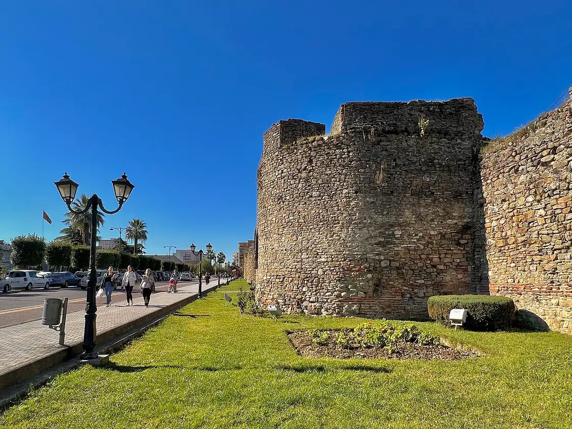
Elbasan sits where the valley opens out, about two thirds of the way to Tirana, and makes the natural break. Its old heart is tucked inside a walled castle - the Ottoman-era ramparts still stand, and inside them is a lived-in quarter of houses, churches, a mosque and cafes rather than a museum piece. Park up, walk the walls, have a coffee or lunch, and stretch your legs before the last push.
From Elbasan the driving changes character completely. The A3 motorway climbs out of town and dives into the long twin-tube Krrabe tunnel - a bit over two kilometres long - before dropping toward the capital. After the valley road it feels almost too easy: you’re in Tirana in around half an hour.
Tirana: the capital
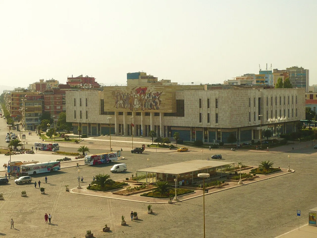
Tirana is a jolt after the lake and the mountains - loud, colourful, growing fast. The heart of it is Skanderbeg Square, a huge open plaza with the equestrian statue, the Et’hem Bey Mosque and the old clock tower on its edge, and the National History Museum behind. Come evening, the Blloku district is where the city eats and drinks. It is worth a night, not a drive-through.
The centre is compact and best seen on foot, and for a view over the whole city and the plain running down to the sea, the Dajti Ekspres cable car climbs the mountain on the eastern edge of town - a good call if you have an afternoon or the weather turns. There’s far more to the city than a square, and the Albania guidebook covers it properly in things to do in Tirana. Parking in the centre is tight, so use your hotel’s spot or a garage and walk.
Durres and the Adriatic
The last leg is the shortest and quickest: Tirana to Durres is about 38 km of motorway, 40 minutes to an hour with traffic, and it ends at the Adriatic. In town, the big Roman amphitheatre sits half-buried among the houses, one of the largest in the Balkans, with a Venetian tower down by the port. For a swim, keep going south of the centre - the sandy beaches at Currila and toward Golem are where the water and the sand are, rather than the working harbour itself. Durres is also Albania’s main ferry port, with sailings to Bari and Ancona in Italy, so if you are carrying on rather than turning back, this is the place to put the car on a boat instead of retracing the drive.
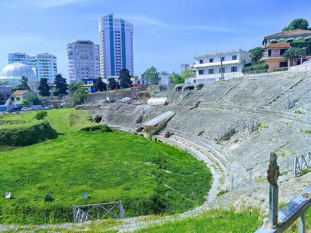
Durres is the natural end of the road, and a good base for the coast: the Albania guidebook’s Durres guide has the detail on beaches, ruins and where to stay.
Practicalities
Taking a hire car across. Sort this before you book, not at the desk. Most companies allow the car into Albania only with a Green Card insurance extension that names both countries, and often a signed cross-border letter; a few cheaper local rentals refuse outright or charge a fee. Ask first. Our car rental guide covers what to check, and getting around North Macedonia has the wider transport picture.
Two currencies. Macedonia uses the denar, Albania the lek. Cards work in cities and euro cash is taken in tourist spots, so don’t overload on either - keep small local notes for coffee, parking and tolls. Both countries are outside the EU and Schengen, so this is a real border with a passport check; EU, UK, US and Canadian citizens cross visa-free, but confirm your case against the official source and our North Macedonia visa requirements. For how the two countries stack up, see North Macedonia vs Albania.
Not driving? Direct buses and furgons run Ohrid to Tirana several times a day, about three to three and a half hours including the border, for roughly 15 to 20 euros. They skip Elbasan’s old town and the Shkumbin scenery, but they’re cheap and painless; the full breakdown, including the border, is in Tirana to Ohrid and Skopje.
When to go. For the Adriatic finish, May to September is the season - warm sea, long evenings. July and August are hottest and busiest, and that’s when the border queues are longest, so cross early. Spring and early autumn give you the valley at its greenest with fewer crowds.
See also
- Things to do in Ohrid - where the trip starts
- Lake Ohrid - the lake you’re leaving
- Renting a car in North Macedonia - cross-border rules
- Getting around North Macedonia - buses, transfers and driving
- Tirana to Ohrid and Skopje - the same trip by bus
- The Albanian capital: things to do in Tirana
- The coast: Durres guide
- More ideas: the full list of North Macedonia routes
Route day by day
- Days on the road
- 2
- Distance
- ≈168 km
- Budget from
- 80 EUR
- Best season
- April, May, June, July, August, September, October
The route at a glance
-
Ohrid (MK)
Route startstop ≈60 min
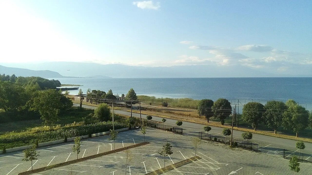
The start, on Lake Ohrid. Leave the lake behind and head west through Struga toward the Albanian border.
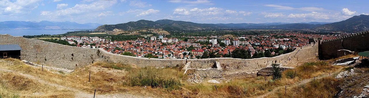
Photo: Pudelek (Marcin Szala) · CC BY-SA 3.0 · Wikimedia Commons ( source) -
Struga (MK)
15 km from the startstop ≈20 min
Last Macedonian town, on the Black Drin. The Kjafasan / Qafe Thane border is ~12 km further west.
Photo: Rakoon · CC0 · Wikimedia Commons ( source) -
Elbasan (AL)
100 km from the startstop ≈60 min
Down the Shkumbin valley into central Albania: an Ottoman town with a walled old quarter inside its castle.
Photo: Sharon Hahn Darlin · CC BY 2.0 · Wikimedia Commons ( source) -
Tirana (AL)
130 km from the startstop ≈180 min
The Albanian capital: Skanderbeg Square, the clock tower and Blloku. The A3 motorway and Krrabe tunnel bring you in from Elbasan.
Photo: Gertjan R. · CC BY-SA 3.0 · Wikimedia Commons ( source) -
Durres (AL)
168 km from the startstop ≈120 min
The Adriatic, ~38 km from Tirana: a Roman amphitheatre in town and swimming beaches to the south.
Photo: AKisn'tOK · CC BY-SA 4.0 · Wikimedia Commons ( source)
Route map
The map with stops loads on click - to keep the page lightweight.
The map didn’t load. Check your connection and refresh the page.