
Galičica National Park: Two Lakes, Magaro & the Pass Road
Galičica National Park sits between Lake Ohrid and Lake Prespa: the pass road with both lakes in view, the Magaro summit, wildlife and how to visit.
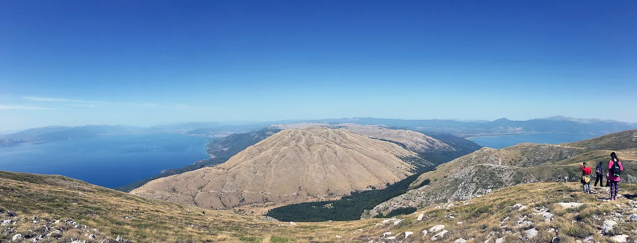
Galičica is the high mountain wall that separates North Macedonia’s two great lakes, and it is the one place where you can stand on a summit and see Lake Ohrid on one side and Lake Prespa on the other. Protected as a national park since 1958, it climbs from the lakeshores to the 2,254 m peak of Magaro, with a scenic asphalt road running right over the top. Most people experience it as a day out from Ohrid: drive the pass for the double-lake view, walk up Magaro, or launch a paraglider off the ridge. Below you’ll find the pass drive, the walk up Magaro, the park’s rare wildlife, the lakeside sights, and how to reach it from Ohrid.
The pass is also day two of the southwest loop from Ohrid, which continues to Prespa, Bitola and Pelister instead of turning back.
What is Galičica National Park?
Galičica was declared a national park in 1958 and covers roughly 24,000 hectares (about 240 km²) of the mountain range of the same name, in the country’s southwestern corner. Its whole reason for existing is its position: a long limestone ridge squeezed between Lake Ohrid to the west and Lake Prespa to the east, with the two lakes sitting at slightly different heights - Ohrid at about 695 m, Prespa at around 850 m - and the mountain rising steeply between them. The range continues south across the border into Albania; the national park is the North Macedonian side.
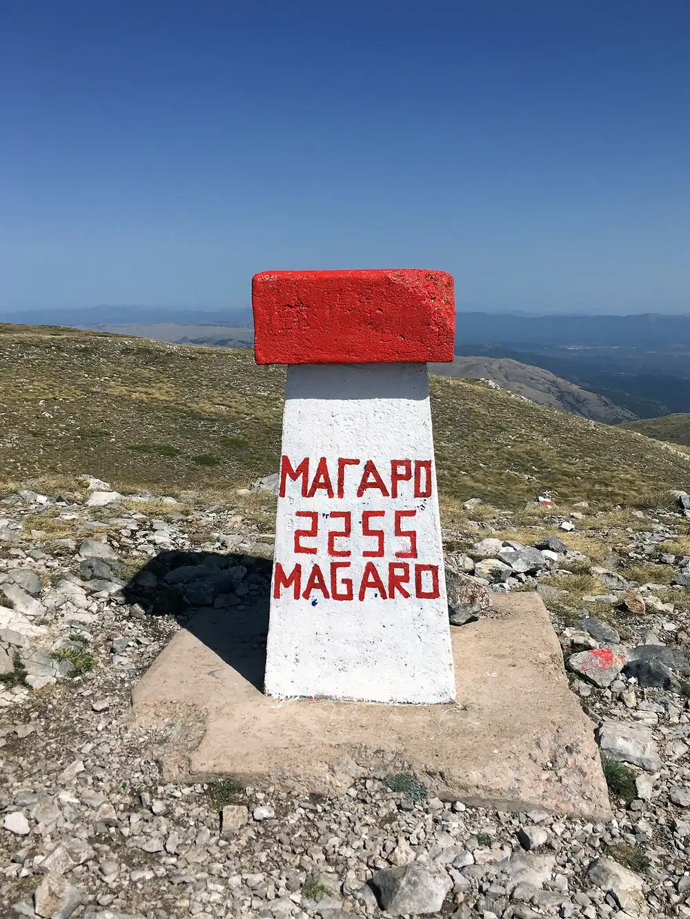
From the shore the mountain reaches up to 2,265 m at its highest point (a spot marked on the border ridge), with the main named summit, Magaro, at 2,254 m - the marker on top is painted 2255, so you’ll see both figures quoted. What makes Galičica special isn’t one headline sight but the geography itself: nowhere else do you get two large, ancient lakes framing a single mountain, which is why the drive over it is one of the best in the Balkans.
The pass road and the two-lake view
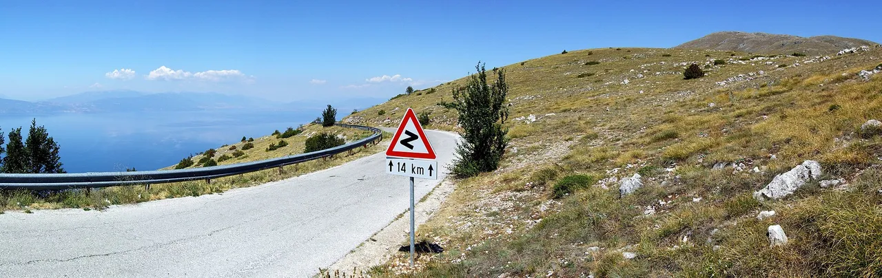
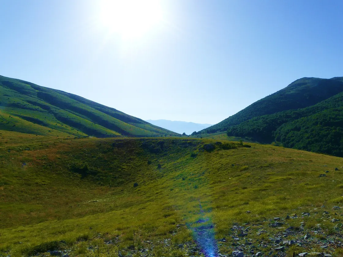
The signature of Galičica is the mountain road (the P-504) that climbs from the Lake Ohrid side up and over the range to the Prespa side. It’s a narrow, winding asphalt road with a run of viewpoints where the whole point of the park suddenly makes sense - both lakes in a single frame, Ohrid deep-blue to the west, Prespa hazier to the east, and the bare grassy summits in between. It’s the easiest way to see the best of the park with no hiking at all, and the obvious loop if you have a car: up from Ohrid or Peštani, over the top, and down to the Prespa villages.
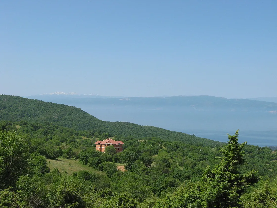
The upper ridge is also one of the region’s best paragliding launches - conditions off the west face above Ohrid are reliable enough that tandem flights run from here in summer, drifting out over the lake. If you’re driving, take it slowly: the road is genuinely narrow with steep drops, and the surface is rougher near the top than the smooth lower section suggests.
Hiking Magaro, the double-lake summit
For the full effect you climb the last stretch to Magaro (2,254 m), the park’s highest named peak. The good news is that because the road already gets you high onto the mountain, the walk to the top is short and, by summit standards, gentle - a broad grassy dome with no exposure and no scrambling, more a steep hill than a climb. From the marker on top the view is the reason people come: Lake Ohrid and Lake Prespa spread out on either side at the same time, with the ridges of Albania and Greece filling the horizon.
It’s the pick of the country’s summits if you want a real mountain top without a hard mountain day, which is exactly why it features in our roundup of the best hikes in North Macedonia. Take water and a windproof layer even in summer - the top is open and the wind rarely lets up - and start reasonably early, because the high pastures cloud over in the afternoon like every mountain here. There are more marked trails across the range for those who want a longer day on foot.
Wildlife and rare plants
Galičica is small but biologically extraordinary, which is the real reason it was protected. Botanists count around 1,600 kinds of vascular plant here across more than 37 habitat types, and the park shelters species found nowhere else on Earth - a dozen endemic flowering plants alone, plus endemic algae, insects and even vertebrates unique to this one mountain and its lakes. The tree line is dominated by hardy relict pines, including the Bosnian pine (Pinus heldreichii), gnarled survivors clinging to the limestone, and two ice-age glacial cirques notch the high slopes. It’s a place naturalists take seriously, not just a viewpoint.
Golem Grad island and the Sveti Naum springs
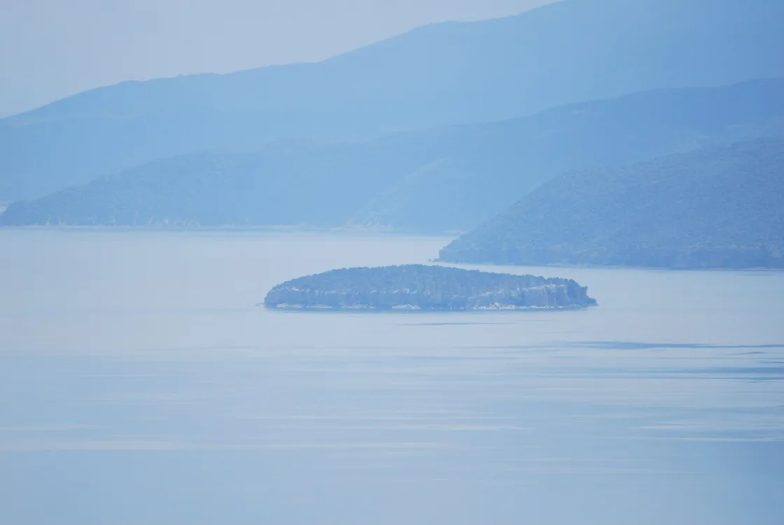
Two of the park’s most memorable features sit down at lake level. On the Prespa side floats Golem Grad, nicknamed “Snake Island” - the only island in all of North Macedonia. It’s an eerie, overgrown archaeological site with Roman and medieval ruins, a colony of pelicans, wild tortoises and, yes, the water snakes that gave it its name; boat trips run out to it from the Prespa shore.
At the park’s southwestern tip, where the Ohrid shore ends, stands the Sveti Naum monastery, one of the most visited spots on the whole lake. Beyond the church itself, the draw is the water: some 30 underwater and 15 shoreline springs well up here, feeding cold, startlingly clear water into Lake Ohrid, best seen from a small rowing boat over the source. Combined with the lakeside villages of Peštani and Trpejca on the drive up, it makes the Ohrid side of the park a full day in itself.
How to get to Galičica
The park sits directly between Ohrid and Struga on the west and Resen and the Prespa basin on the east, so almost everyone comes from the Ohrid side.
| From | Distance | Time |
|---|---|---|
| Ohrid → pass viewpoints | ~38 km | ~50 min by car |
| Ohrid → Sveti Naum (park edge) | ~29 km | ~40 min along the shore |
| Bitola → Prespa side (via Resen) | ~75 km | ~1.5 h |
| Skopje → Ohrid | ~170 km | ~2.5-3 h, then up |
There’s no useful public transport up the mountain, so the pass drive really needs a rental car or a booked tour; if you’re picking one up on the lake, our guide to car rental in Ohrid has the local desks, deposits and the winter dates when this road is shut; buses along the Ohrid shore will get you as far as Peštani or Sveti Naum but not over the top. If you’re based on the lake, Galičica slots naturally into an Ohrid itinerary - see things to do in Ohrid for the rest of the area, and our best time to visit guide for the seasons.
When to go and practical notes
- Late spring to autumn (roughly June-October) is the window for the summit and the full pass drive; the high road can be closed by snow in winter, and cloud builds over the tops most summer afternoons.
- Entry is free to drive and walk; you pay only for guided hikes, paragliding, or the boats to Golem Grad and the Sveti Naum springs.
- Drive carefully. The pass is narrow and winding with real drops and a rougher surface up high - not a road to rush.
- Bring layers and water. The ridge is open and windy even when the lakeshore is hot; there’s no shop once you leave the villages.
- Money and visas. Prices are in denar (MKD), steady against the euro at about 61.5 to €1; carry cash. US, UK, EU and Ukrainian citizens travel visa-free for 90 days, while Russian citizens need a visa (since 21 March 2022) - rules change, so confirm with an official source. More in our planning hub.
Read also
- Browse all attractions in North Macedonia
- The lake on its western flank: Lake Ohrid
- The lake on its eastern flank: Lake Prespa
- Base yourself on the shore: things to do in Ohrid
- Where Magaro ranks among the country’s climbs: best hikes in North Macedonia
- Its mountain neighbour across Prespa: Pelister National Park
On the map
The map loads on click - to keep the page lightweight.
The map didn’t load. Check your connection and refresh the page.
Admission and opening hours
- Admission price
- Free to drive and walk. Guided hikes, paragliding and boat trips on the lakes are paid separately.
- Opening hours
- Open year-round in daylight; the high pass road can be closed by snow in winter.
The mountain road is narrow and winding - drive carefully, and check conditions before heading up out of season.
Details checked: July 16, 2026
Distance
- Skopje ≈190 km · ~3-3.5 h: ~170 km to Ohrid, then ~38 km up to the pass
- Ohrid ≈20 km · ~30-40 min up to the pass viewpoints
- Bitola ≈75 km · ~1.5 h via Resen to the Prespa side
Read also

What to see · 11 min read
Skopje Brutalist Architecture Walking Guide
Verified · September 3, 2026Walk Skopje's post-1963 concrete: Post Office, GTC, Tange's station and MoCA. Dates and architects from named sources.

What to see · 9 min read
Plaošnik & St Clement's: Ohrid's Sacred Hill
Updated · August 25, 2026Plaošnik in Ohrid: St Clement's church, early Christian mosaics and Slavic literacy's cradle - what to see, the walk up and looping Kaneo.

What to see · 9 min read
Skopje Museums: Archaeology to Mother Teresa
Updated · August 23, 2026Four Skopje museums worth an afternoon: archaeology, Mother Teresa, the Holocaust center and Macedonian Struggle - hours, tickets and how to visit.

What to see · 12 min read
Bigorski Monastery: The Carved Wonder of Western Macedonia
Updated · August 4, 2026Sveti Jovan Bigorski: the walnut iconostasis with 500+ carved figures, what the 2009 fire took, and how to get there from Skopje or Ohrid.