
Pelister National Park: Baba Mountain, Lakes & Molika Pines
North Macedonia's oldest national park above Bitola: the Pelister peak, two glacial lakes and the rare molika pine, plus trails and how to visit.
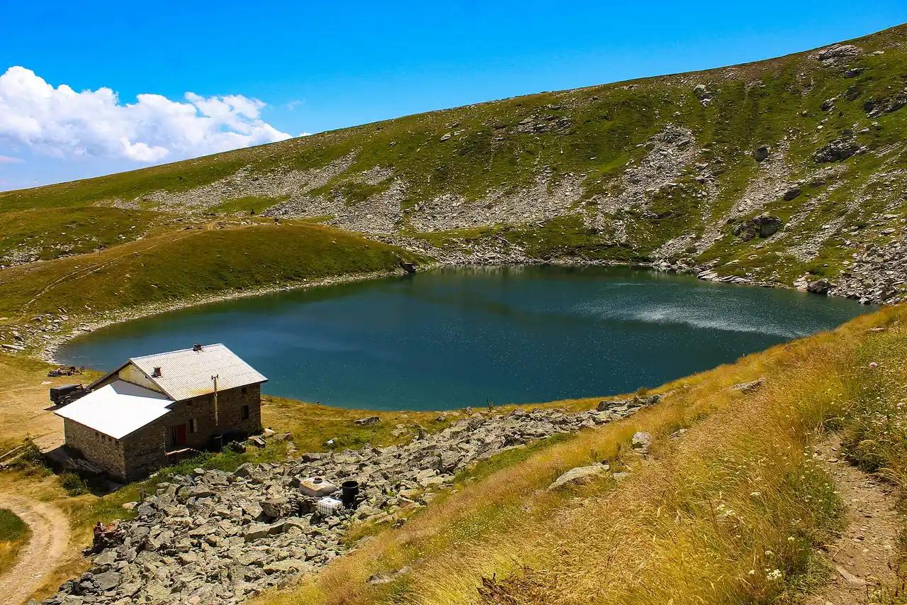
Pelister is the mountain wall you see rising straight behind Bitola, and it’s North Macedonia’s oldest national park, protected since 1948. The draws are specific: the Pelister peak at 2,601 m, two high glacial lakes locals call Pelister’s Eyes, and a forest of molika, a rare five-needled pine that grows almost nowhere else. Most visitors come up from Bitola for a day - a walk in the pines, a drive to the trailhead, and a hike to the lakes if legs and weather allow. This guide covers what’s up there, which trail to pick, and how to reach it.
A rental from Ohrid can fold Pelister into the southwest loop after Bitola, then drive back to the lake.
What is Pelister National Park?
Pelister was declared a national park on 30 November 1948, which makes it the oldest of the country’s four parks and one of the first anywhere in the former Yugoslavia. It covers about 17,150 hectares (171.5 km²) of the Baba massif, the high range south of Bitola, and climbs from roughly 890 m at its foot to the 2,601 m summit - the third-highest mountain in North Macedonia. A point that trips people up: Baba is the name of the mountain, while Pelister is its top peak and the name the whole park took.
What makes Baba feel different from the country’s other big massifs isn’t one headline sight but the texture of the place: dark pine forest giving way to open grassy ridges, glacial cirques holding cold lakes, and long views west toward Lake Prespa. It sits right above the country’s second city, so unlike remote Mavrovo in the far west, you can be sipping coffee on Bitola’s promenade an hour after coming off the hill.
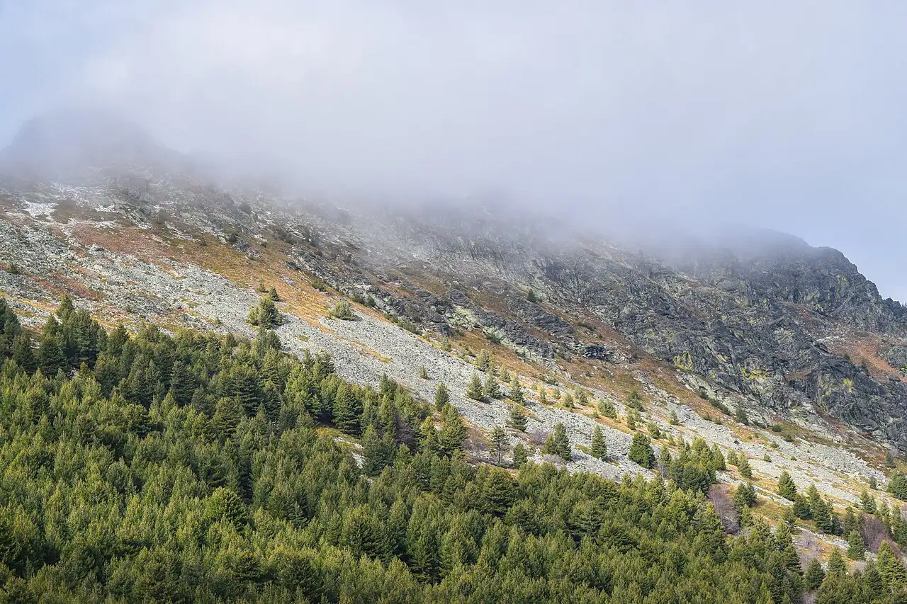
The molika pine, the tree that defines it
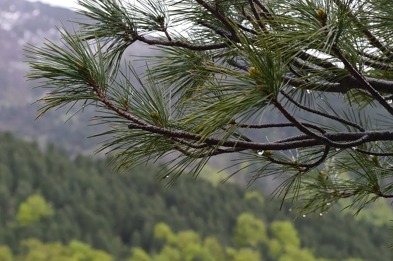
If you notice one thing on Pelister, it’s the pines. The molika (Pinus peuce), or Macedonian pine, is the park’s emblem and the reason its forests look the way they do: a five-needled pine with soft, drooping tufts and tall, straight trunks, quite unlike the stiff two-needle pines lower down. It’s a Tertiary relict - a survivor from a warmer age millions of years ago - endemic to a handful of central-Balkan mountains, and it was first described for science by the botanist August Grisebach in 1843, on this very range.
The trees grow to 30-40 m and live two to three centuries; some of the molikas on Pelister are over 200 years old. They form dense, cool forest up to around 2,000 m, higher than most pines manage, which is why you walk through timber almost to the lakes. Look closely at a branch and the giveaway is the needles in bundles of five, soft to the touch and often beaded with rain up here.
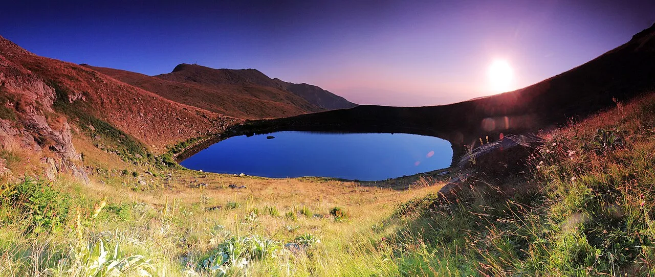
Pelister’s Eyes: the two glacial lakes
The high point of most visits, literally and otherwise, is the pair of glacial lakes on the ridge. Gouged out by Ice-Age glaciers and sitting in bare rock cirques, they’re known as Pelister’s Eyes (Pelisterski Oči). The larger, Golemo Ezero (Big Lake), lies at about 2,218 m - one of the highest lakes in the country - and is roughly 4 hectares across and some 14 m deep, with a small stone mountaineering hut on its shore that doubles as a rest stop and shelter. About two kilometres northwest and a touch lower, at around 2,180 m, is Malo Ezero (Small Lake), shallower and quieter.
The water is snowmelt-cold even in August, and patches of old snow linger in the shaded gullies above the lakes well into June. When the high ground thaws is clearer from North Macedonia’s weather month by month. This is the classic Pelister day out: up through the pines, out onto the open ridge, and down to the Big Lake for lunch by the hut before turning back.
Hiking Pelister: the peak or the lakes
Almost everything on foot starts at Dom Kopanki, a mountain hut at around 1,600 m. You reach it on a rough mountain road up from the village of Trnovo, usually parking by Hotel Molika (the little ski base lower down, at about 1,420 m) and walking the last pull up to the hut. From Kopanki a network of more than 40 marked trails, about 100 km in all, fans out across the range, but two objectives cover most of what people come for.
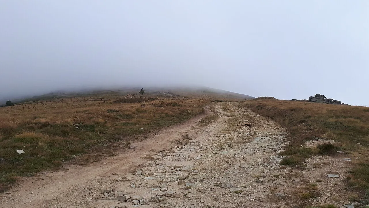
The lakes are the popular target: roughly 3 to 4 hours one way from Kopanki, a steady rather than brutal climb through forest and onto the ridge, moderate but long. The summit is the bigger commitment - about 5 to 6 hours round trip to the top of Pelister and back, more strenuous, on open ground exposed to weather. Fit walkers with an early start string both together, lakes and peak, in a long 8 to 9 hour loop. If you would rather stay low, the easy forest walk from Trnovo down to the old village of Malovište takes about three hours and needs no summit legs at all.
A few honest cautions. The mountain makes its own weather, and cloud can swallow the ridge by early afternoon even on a clear morning, so start early and carry a layer and a rain shell whatever the forecast. There’s no public transport up the mountain, so you need a car or taxi to the trailhead. And the summit usually holds snow until mid-June - before then, the lakes are the safer aim.
Skiing and wildlife
Pelister has a small winter side too. A modest ski area at Kopanki, next to Hotel Molika, runs roughly December to March - a couple of short runs and a friendly, family scale rather than a resort. If you want proper pistes, the country’s main ski centre is over at Mavrovo; Pelister is better thought of as a place for a snowy walk in the pines with Bitola close by.
The park is genuinely wild for its size. It shelters brown bear, grey wolf, wild boar, chamois and deer, along with the European otter in its streams and birds such as the bearded vulture overhead, among more than 1,050 plant species. You’re very unlikely to meet the big animals - they keep away from the trails - but the richness is part of why the mountain was protected so early.
Where to base yourself: Bitola and the villages
The natural base is Bitola, the elegant southern city just below the park, with the fullest choice of hotels, cafés and the long Širok Sokak promenade to come back to. From the centre it’s only about 7.5-8 km to the village of Trnovo, where the rough park road begins its climb into the mountains.
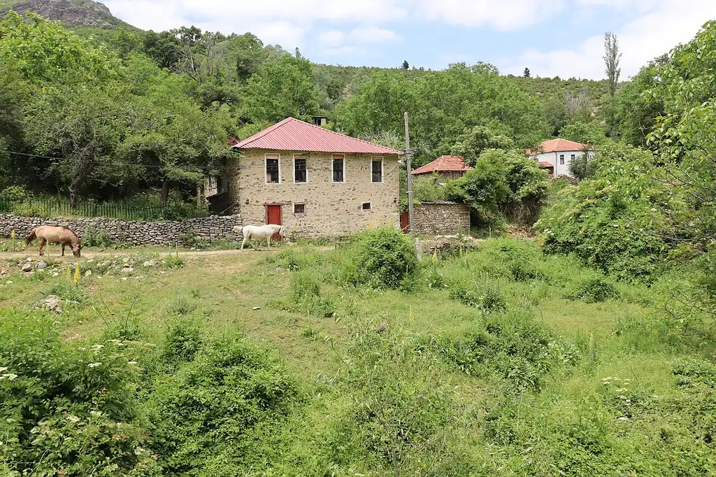
For something closer to the trees, two foothill villages make characterful stops. Dihovo, right at the park boundary, has reinvented itself as a walkers’ base with family guesthouses (Villa Dihovo is the well-known one) and is a common starting point for hikes. Malovište, tucked in a side valley, is an old Aromanian (Vlach) mountain village of stone houses, cobbled lanes and a fine old church - half-empty now, but one of the most atmospheric hamlets in the region and the endpoint of that easy forest walk.
How to get to Pelister
From Bitola. This is the everyday approach: about 7.5-8 km from the city up to Trnovo, then the rough mountain road climbing on to the Kopanki trailhead - roughly 15-18 km and 30-40 minutes’ drive all told, ending by Hotel Molika with a short walk up to the hut. There’s no bus up the mountain, so drive, take a taxi, or join a guided hike; a rental car is much the easiest way to reach the trailhead.
From Skopje. Bitola is about 170 km south of the capital, roughly 2.5 to 3 hours on the A1/E-75, and Pelister sits right above it - see getting around North Macedonia for buses to Bitola if you’re car-free, then arrange local transport up.
From Ohrid. Ohrid to Bitola is about 70 km (1 to 1.5 hours), and Pelister rises just above the city, so reckon on around 90 km all the way to the trailhead - an easy add-on to a southwestern loop.
| Route | Distance | Time |
|---|---|---|
| Bitola → Kopanki trailhead | ~15-18 km | ~30-40 min by car |
| Skopje → Bitola | ~170 km | ~2.5-3 h |
| Ohrid → Bitola | ~70 km | ~1-1.5 h |
| Ohrid → Pelister (trailhead) | ~90 km | ~1.5-2 h |
Distances and times are approximate, and the park road is rough in places - check conditions, and don’t attempt it in snow without the right vehicle.
When to go and practical notes
- Summer (June-September) is the main hiking window; the summit is usually clear of snow from mid-June, and the lakes are at their best.
- Autumn turns the beech and grassland gold and is quiet and beautiful, though weather is less settled.
- Winter (December-March) brings the small Kopanki ski tow and snowy forest walks; come prepared for real cold at altitude.
- Entry is free and there’s no ticket to walk; you pay only for the ski tow, a guide, or a bed in the villages.
- Money: prices are in Macedonian denar (MKD), steady against the euro at roughly 61.5 to €1. Carry cash for village guesthouses and the hut.
- Visas: US, UK, EU and Ukrainian citizens travel visa-free for 90 days in any 180; Russian citizens need a visa (since 21 March 2022). Rules change - confirm with an official source. More in our planning hub.
For where Pelister fits in a wider trip, our 7-day North Macedonia route links Bitola and the south with Ohrid and Skopje, and the best time to visit guide sets out the seasons.
Read also
- Browse all attractions in North Macedonia
- The gateway city: things to do in Bitola
- Another high-altitude Pelagonia stop: Kruševo travel guide
- Its lake neighbour on the far side of the range: Lake Prespa
- The country’s main mountain park: Mavrovo National Park
- How Pelister ranks among the country’s climbs: best hikes in North Macedonia
- Fit it into the 7-day North Macedonia route
On the map
The map loads on click - to keep the page lightweight.
The map didn’t load. Check your connection and refresh the page.
Admission and opening hours
- Admission price
- Free to enter and walk. Parking at the Dom Kopanki hut; the ski tow and guided hikes are paid separately.
No public transport into the park - drive or taxi from Bitola to Kopanki, then hike. The summit is usually snow-free from mid-June.
Details checked: July 13, 2026
Distance
- Skopje ≈170 km · ~2.5-3 h by car to Bitola, then up
- Ohrid ≈90 km · ~1.5-2 h to the trailhead
- Bitola ≈16 km · ~30-40 min up to the Kopanki trailhead
Read also

What to see · 11 min read
Skopje Brutalist Architecture Walking Guide
Verified · September 3, 2026Walk Skopje's post-1963 concrete: Post Office, GTC, Tange's station and MoCA. Dates and architects from named sources.

What to see · 9 min read
Plaošnik & St Clement's: Ohrid's Sacred Hill
Updated · August 25, 2026Plaošnik in Ohrid: St Clement's church, early Christian mosaics and Slavic literacy's cradle - what to see, the walk up and looping Kaneo.

What to see · 9 min read
Skopje Museums: Archaeology to Mother Teresa
Updated · August 23, 2026Four Skopje museums worth an afternoon: archaeology, Mother Teresa, the Holocaust center and Macedonian Struggle - hours, tickets and how to visit.

What to see · 12 min read
Bigorski Monastery: The Carved Wonder of Western Macedonia
Updated · August 4, 2026Sveti Jovan Bigorski: the walnut iconostasis with 500+ carved figures, what the 2009 fire took, and how to get there from Skopje or Ohrid.