
Kokino Observatory: Europe's Ancient Megalithic Sky-Watcher
Kokino megalithic observatory: what the Bronze Age site really is, the truth behind the NASA claim, and how to get there from Skopje.
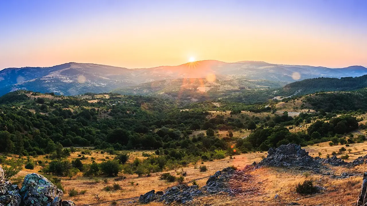
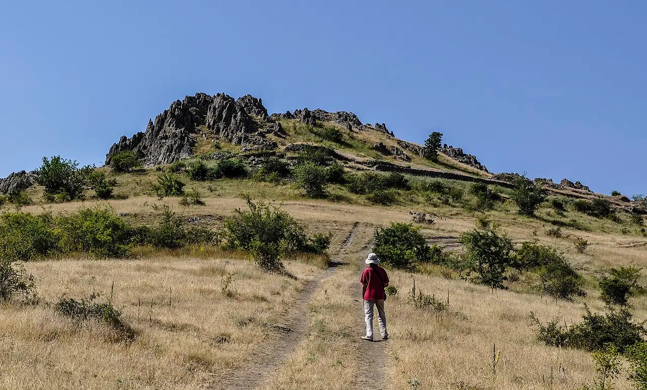
Kokino is a Bronze Age hilltop in the far north-east of North Macedonia where people cut seats, sight-lines and notches into volcanic rock to follow the sun and the moon around 1800 BC. It stands at 1,013 m on a rocky crest called Tatikjev Kamen, roughly 75 km and an hour and a half from Skopje, and it’s open ground: no gate, no ticket office, no closing time. Come for sunrise and you see the place doing the one job it was built for, with the light climbing over the eastern ridge right where the markers point.
One line deserves deflating before you drive out. Every tour listing and half the travel blogs will tell you NASA ranked Kokino the fourth most important ancient observatory on Earth. NASA published no such ranking. What actually happened is more interesting, and knowing it changes how you read the hill once you’re standing on it.
What is actually on the hill
The crest is the eroded remains of an extinct volcano in the Kratovo-Zletovo volcanic area - the same geology that gave nearby Kratovo its crater setting and Kuklica its stone pillars. The rock is andesite, and it cracks vertically and horizontally into near-cubic blocks. That’s the whole reason a Bronze Age community could build anything precise here: nature supplied the masonry, and people only had to trim it.
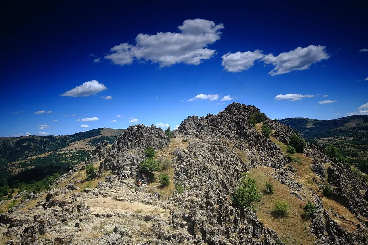
The observatory proper is small: about 100 m east to west and 50 m north to south, roughly half a hectare, arranged on two platforms with 19 m of height between them. On the lower, western platform sit four stone “thrones” in a row, facing east so that anyone seated there looks across the upper platform to the rocky skyline beyond. That skyline is the instrument. Along it are nine cut markers: three fix the sunrise at the summer solstice, the equinoxes and the winter solstice, and the rest fix the rising of the full moon at its extreme northerly and southerly positions. Two more cuttings were used to measure the length of lunar months, which is how the site’s excavators reconstructed a 19-year lunar calendar - twelve years of twelve lunar months and seven years of thirteen. You won’t see the calendar written on a board; you’re reading rock.
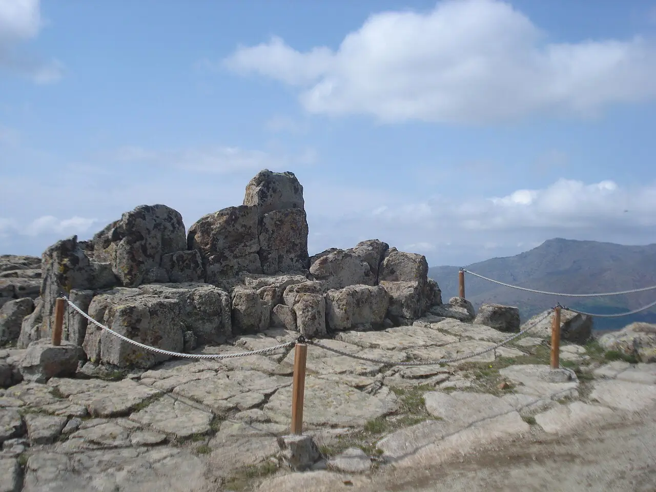
Then there’s the ritual described in the Macedonian nomination file, which is the part people remember. In the last days of July, sunrise passes through the opening of one carved marker, then along the right edge of a trench cut into the rock wall between the platforms, and lands on the second throne only - the seat of the community’s most powerful figure, his authority renewed by the sun at the close of harvest. Twenty hand grinders were found at the base of that marker, which fits the harvest reading. Whether or not you buy every part of it, standing on that spot at first light is a strange and quiet thing to do - and that’s the visit worth making.
The NASA story, straight
Here’s the sequence. In 2005 NASA’s Sun-Earth Connection Education Forum ran an education campaign called Ancient Observatories: Timeless Knowledge and produced a poster listing fifteen ancient observatory sites. Kokino got a brief mention on it. A few weeks later, on 11 May 2005, the Southeast European Times ran a story headlined “Macedonia’s Megalithic Kokino Observatory Places 4th on NASA List”, and that headline is the origin of every “4th in the world” claim you’ll read today. NASA didn’t rank observatories by importance or by age.
The academic picture is also mixed. A recent survey of ancient “observatories” describes Kokino as a particularly problematic case, and when North Macedonia formally nominated the site for the UNESCO World Heritage List in 2011, the nomination was rejected: with that many candidate viewing points and that many notches in a rocky ridge, some alignments will appear by chance. Kokino remains on the Tentative List (submitted January 2009) and has national protection as a “property under temporary protection” since November 2008. Don’t let that put you off the drive.
While we’re deflating things, the other common line is wrong too: Kokino is not older than Stonehenge, whose earliest phases run to around 3000 BC.
None of that makes the trip worse. The archaeology is real and substantial. The pottery starts in the Early Bronze Age, the 19th to 17th century BC, and most of it’s later, from the 14th to the 11th; the mould for casting bronze axes and a pendant was the first of its kind found in the country; vessels of offerings were pushed into cracks in the rock, which the excavators read as a fertility cult treating the rocky summit as the body of the mother goddess. On the south-east slope below the observatory a settlement lived from the 19th to the 7th century BC - about 1,200 years, from the Bronze Age into the Iron Age. This was a genuine high place, and the sunrise sight-lines are worth judging with your own eyes - you’ll decide for yourself what the notches mean.
Getting to Kokino
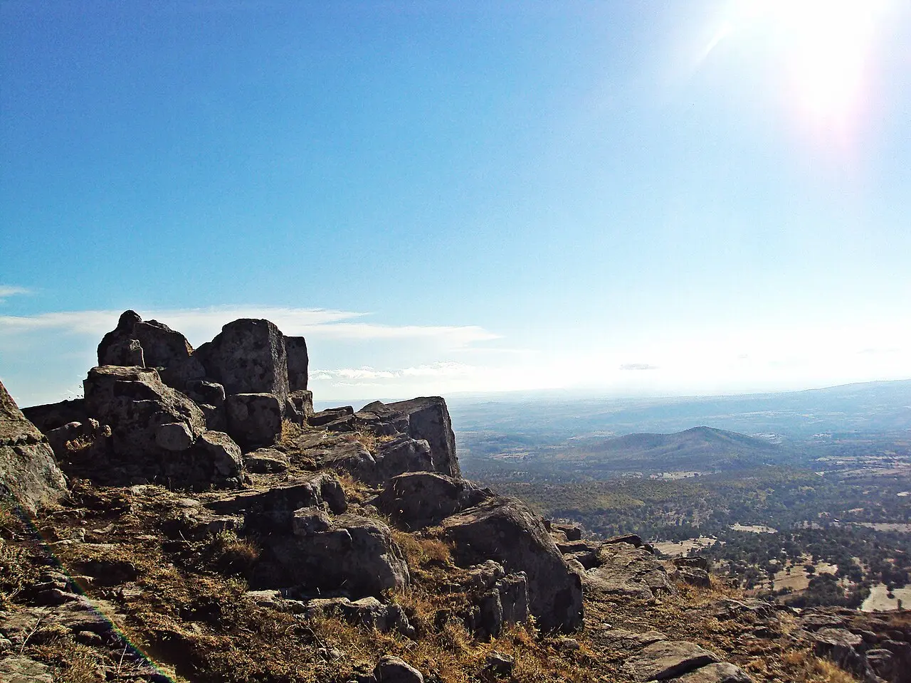
Distances here are quoted inconsistently, so treat them as a range. UNESCO’s file says 19 km north-east of Kumanovo, Wikipedia says about 30 km, and Macedonian media in June 2026 gave roughly 35 km from Kumanovo and about 75 km from Skopje. In driving terms, allow an hour and a half from Skopje and around 45 minutes from Kumanovo.
Leave the Kumanovo to Kriva Palanka road at the turning for Staro Nagoricane and the Prohor Pcinjski monastery, then follow signs through the hills to the village of Kokino. Reports on the last stretch differ, and this is the single most useful thing to check before you go: Macedonian coverage in June 2026 describes an asphalt road up to the site with the final 500 m on foot, while travel accounts from recent years describe several kilometres of dirt track ending at a free earth car park with an information board, plus a 10 to 15 minute walk uphill. Either way a normal car manages it in dry weather, driven slowly. After heavy rain or snow, ask locally in Kumanovo first - you don’t want to discover the mud at dawn.
Without a car it gets awkward. Buses run Skopje to Kumanovo in about an hour and go frequently, but onward public transport towards Kokino is unreliable, and one traveller’s account has a driver simply refusing the route; the return the same day is the real risk. A taxi from Kumanovo runs around 20 EUR including waiting time, which is the sane fallback. Otherwise, hire a car - see our guide to renting a car in North Macedonia and getting around North Macedonia for the bus network.
| Leg | Distance | Time |
|---|---|---|
| Skopje → Kokino | ~75 km | ~1 h 30 min by car |
| Kumanovo → Kokino | ~30-35 km | ~45 min by car |
| Kratovo → Kokino | ~45-55 km | allow about an hour |
Figures are approximate and sources disagree; the Kratovo leg in particular runs on slow hill roads and nobody publishes a firm number for it. Confirm locally before an early start.
When to go, and what to bring
Sunrise is the point of the exercise, which means driving a mountain road in the dark and arriving with a head torch. The solstices and equinoxes are the obvious dates, and the June solstice now draws an organised gathering: on 21 June 2026 the Minister of Culture and Tourism joined the sunrise at Kokino, part of a programme marking 25 years since the site was found in 2001. The quieter and arguably more meaningful morning is the end of July, the mid-summer ritual sunrise described in the nomination file.
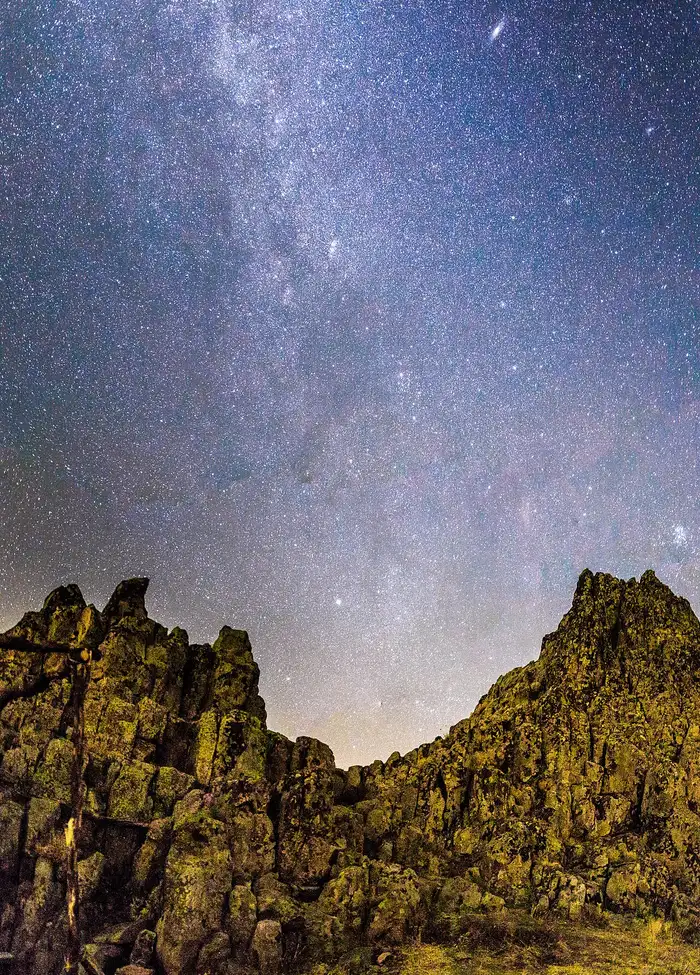
Nights are the other reason to come. There’s almost no light pollution on this ridge and the skyline gives you a clean horizon, so the Milky Way is easy and the Perseids in mid-August are excellent. Take warm layers even in summer: at 1,013 m, with wind, a pre-dawn wait is cold.
Practicalities are short because the site has nothing. No cafe, no toilet, no water, no shade, no staff. Bring water, sun cover and shoes with grip; the rock is uneven and the drop off the crest is real. On the entry fee, published information conflicts: most visitors describe it as free, one reported a sign charging 100 denars for adults and 50 for children. Carry a few small denar notes and treat it as unresolved.
Making a day of it
Kokino works best combined rather than alone, because the drive is long for a 40-minute visit. The natural pairing is the north-eastern loop: Kratovo, the old mining town built inside a volcanic crater with its stone towers and arched bridges, and the eroded stone pillars of Kuklica nearby, where the same andesite that made the markers up here has been left standing as a field of capped columns. All three sit in the same volcanic district, which is the tidiest geology lesson in the country and makes the day feel coherent instead of scattered. Read the Kuklica page before you go: entry there has been disputed since mid-2026 and the situation on the ground keeps moving.
If you’re basing yourself in the capital, our best day trips from Skopje sets Kokino against the closer options, and the north-east forms the eastern leg of our 10-day North Macedonia itinerary. One night in Kratovo or Kumanovo turns a rushed round trip into an easy sunrise.
Read also
- Browse everything in attractions in North Macedonia
- The nearest base with real character: things to do in Kratovo
- Start in the capital: things to do in Skopje
- Plan the driving: driving in North Macedonia
- Budget the trip: North Macedonia trip cost
Photos
On the map
The map loads on click - to keep the page lightweight.
The map didn’t load. Check your connection and refresh the page.
Good to know
Open ground with no gate, no staff and no facilities. We could not confirm a published entry tariff: most reports say free, one visitor reported a sign at 100 den adult / 50 den child. Carry small denar notes and check on the spot.
Details checked: July 23, 2026
Distance ≈75 km · ~1 h 30 min by car via Kumanovo
- Skopje ≈75 km · ~1 h 30 min by car via Kumanovo Turn off the Kumanovo - Kriva Palanka road towards Staro Nagoricane. Accounts of the last stretch differ: Macedonian media in June 2026 describe asphalt to the site with the final ~500 m on foot, older travel reports a dirt car park and a 10-15 min walk uphill.
Read also

What to see · 11 min read
Skopje Brutalist Architecture Walking Guide
Verified · September 3, 2026Walk Skopje's post-1963 concrete: Post Office, GTC, Tange's station and MoCA. Dates and architects from named sources.

What to see · 9 min read
Plaošnik & St Clement's: Ohrid's Sacred Hill
Updated · August 25, 2026Plaošnik in Ohrid: St Clement's church, early Christian mosaics and Slavic literacy's cradle - what to see, the walk up and looping Kaneo.

What to see · 9 min read
Skopje Museums: Archaeology to Mother Teresa
Updated · August 23, 2026Four Skopje museums worth an afternoon: archaeology, Mother Teresa, the Holocaust center and Macedonian Struggle - hours, tickets and how to visit.

What to see · 12 min read
Bigorski Monastery: The Carved Wonder of Western Macedonia
Updated · August 4, 2026Sveti Jovan Bigorski: the walnut iconostasis with 500+ carved figures, what the 2009 fire took, and how to get there from Skopje or Ohrid.